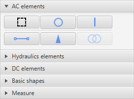
The user interface of EA-GIS is intuitive and easy to use. On the left side of the window there is a toolbar for creating custom objects. All of GIS geometry is made of 3 simple objects: point, polyline and polygon. To make it simpler for the user to create schemes, standard EA-PSM icons have been used for elements. For example, to create a substation the user would choose the substation button and draw a polygon on the map. Individual coordinates can be adjusted later.
When creating an object, user has to choose which layer the object will belong to. For convenience, default layers have been created and are selected automatically once the user clicks an element icon in the toolbar.
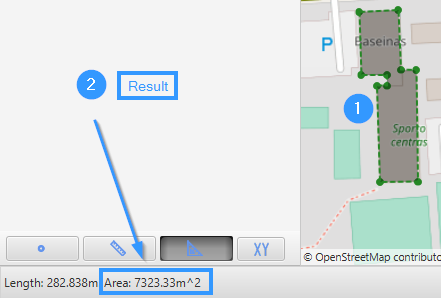
The toolbar also has a “Measure” pane in which measurement tools can be accessed. The user may measure length or area on the map and the results will be displayed in the bottom left corner of the window.
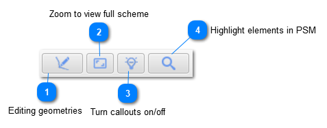
At the top of toolbar, there are few new buttons:
Editing geometries
When this button is enabled, it is possible to edit GIS geometries by clicking on elements, adding new etc.
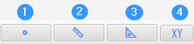
1 - Point coordinates. Allows to point anywhere on the map and shows coordinates of added point. Point and coordinates are only showed if button is enabled and are hidden once the button is disabled.
2 - Measure length. Allows to add multiple points on the map and shows the total length between the points:
3 - Measure area. Allows to add up points on the edges of measured surface and measures the area of that selected surface:
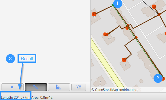
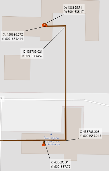
4. Measure and display object geometries. After enabling this button, it is possible to left click on the element with mouse and element geometries are shown:
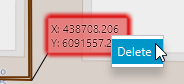
Geometries stay on the GIS view even after this button is disabled. In order to remove geometries data, user should right click on data box with mouse and select "Delete":