22.4.1. Linking polyline and point elements layers
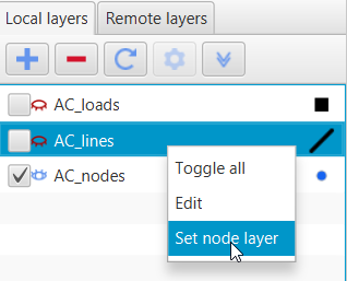
This function helps to draw GIS schemes more quickly. To enable this function user should right click on the polyline and select Set node layer:
After that, user can choose the predefined layer of point elements that will appear after inserting a new polyline in this layer.