Callout allows to depict certain information about element on GIS map.
There are four types of callouts in GIS:
Coordinate callout;
Results callout;
Property callout;
Dataset callout.
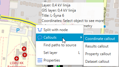
In order to show element's data on the map, user should move mouse cursor over element until it is marked with yellow background, right click on the element, select Callouts and type of callout:
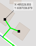
Coordinate callout shows geographical data of element:
By clicking Results callout user can choose what results to depict. User should mark what to show:
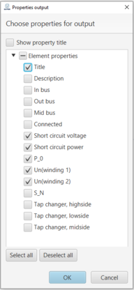
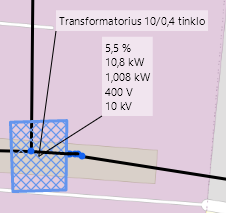
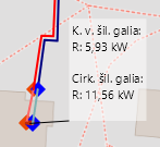
Property callout allows to show certain properties about element. User can choose what to show, for example, for transformer:
In order to change elements properties, user should change them by selecting element in EA-PSM (not GIS) window and opening its properties window by double clicking on it or by right click.
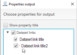
Dataset callout shows titles of Datasets and current data value if any dataset is linked to that certain element. It can be selected in the menu window what dataset to depict:
Callout rectangulars can be dragged freely by simply draging it with a mouse.
Callout view on the map can be enabled by clicking on and disabled by button on the GIS toolbar.
Hint: it is possible to drag callout to desired place of scheme.